
Designed & maintained by Carol Gingell

© C.Gingell 2006-
© Broadland Memories 2006-


 1970s History
1970s Memories
1970s History
1970s Memories
1970s Photo Gallery
More photographs from the Barber Family’s holidays on the Norfolk Broads in the 1970s.





Two more misty shots which look as though they were taken from the moorings at St Benet’s Abbey. The wherry Albion approaches Fleet Dyke.
Albion entering Fleet Dyke on her way to South Walsham in the late 1970s.
The view looking upstream from Ludham Bridge in the late 1970s.




Another well known Broadland view -
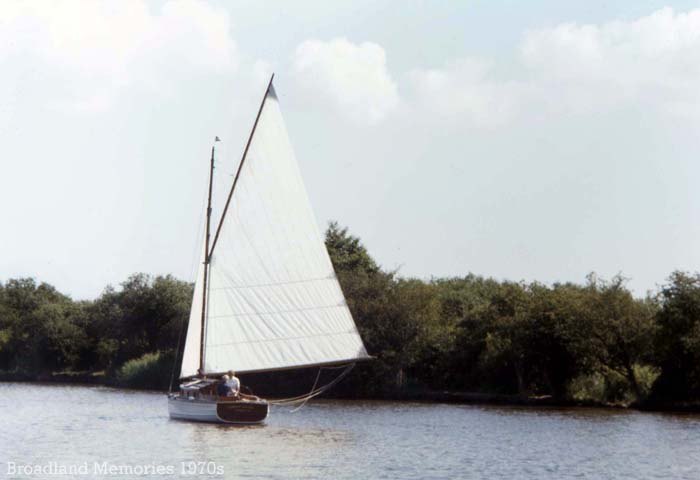
Unidentified sailing cruiser on the Norfolk Broads c1978.
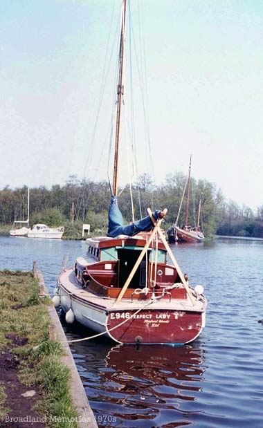
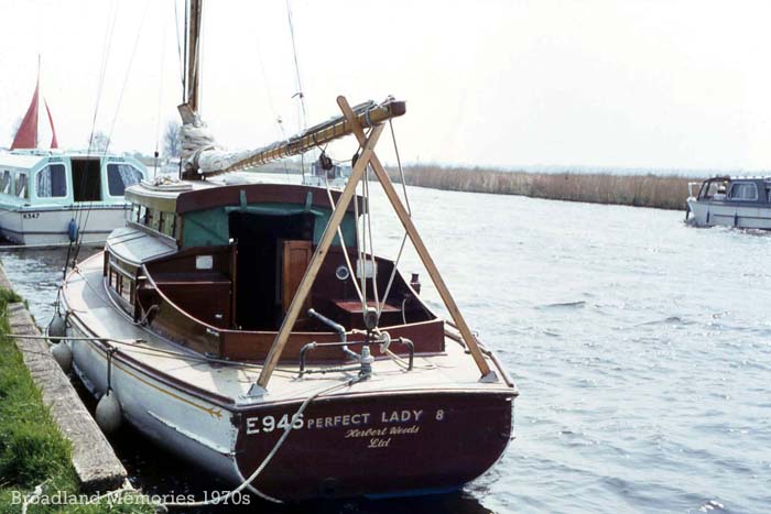
Another year, and another yacht hire. This was E946 Perfect Lady 8 from the Herbert Woods fleet. This looks like Barton Turf which was a popular mooring spot for the family, with its proximity to good sailing on Barton Broad.
Perfect Lady 8 once again. This 28ft, 4 berth yacht cost between £90 and £128 per week to hire in 1978. This looks like the family were moored at St Benet’s Abbey here.
Another view of Perfect Lady 8 taken at the same time as the previous image.
Taken on board Perfect Lady 8 whilst underway in the late 1970s.

The Barber family appear to have switched to sailing holidays on the Broads in the mid to late 1970s. This was S139 Cresta which was built by Martham Ferry Boats and was one of fleet which included several classes from the 21ft Crestette to the 5 berth, 28ft 6in Cresta Maria. Hoseason’s brochure described the Cresta fleet as; “Modern high-
Another view of Cresta which was 26ft in length, slept 2-
This is Leander 2 on Malthouse Broad in the mid 1970s with St Helen’s Church at Ranworth seen in the background. Originally built by Chumley and Hawke at Horning, she later became part of the Martham Boat Building and Development Company (not to be confused with Martham Ferry Boats), where she is still available to hire. In 1975, a week’s hire cost between £33 and £47 depending on the time of year.
Another view of Leander 2 on Malthouse Broad in the mid 1970s.
“Burefield” at Horning c1975.
The village sign at Horning which features St Benedict’s Church on the left and a wherry and mill on the right. The shield in the centre is that of S Benet’s Abbey. The sign reads;”The name means ‘The folk who live on the high ground between the rivers. In 1020 AD the manor was given by King Canute to the Abbey of St Benet at Hulme, and the Bishop of Norwich as abbot of St Benet’s is still the lord of the manor. The parish extends to Thurne Mouth and includes the ruins of the abbey & St. James Hospital, also the 13th century church of St Benedict.” The sign has since been repainted to depict Thurne Mill on the right.
The village sign for Neatishead pictured in the mid to late 1970s. This also bears the shield of St Benet’s Abbey in the centre, whilst the shield on the left is that of the Preston Family who own much of the land on which the village was built and whose family home has been at the nearby Hall at Beeston St Lawrence since the mid 17th century. The shield on the right commemorates the RAF Neatishead Radar base which was established during the Second World War. The former base is now open as a museum showing the history of radar development and it’s role during both WW2 and the Cold War.
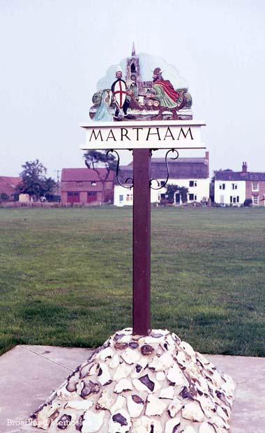
Martham village sign depicts different scenes on either side and was designed by Mr T.W. Fanthorpe, incorporating ideas suggested by local residents. It was erected and unveiled in October 1975. This side shows St Mary’s Church with a knight defending a maiden from a Viking raider.
The other side of the Martham village sign shows a typical Norfolk wherry and a wind pump (of which the village has two). The name Martham is Saxon in origin and means “the ham of the martens” or home of the polecats, referring to the wild polecats which once lived on the surrounding Broadland marshes.
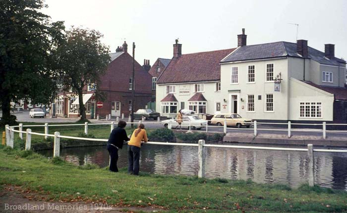
Martham village centre c1976, overlooking one of the two village ponds. In the background is the Kings Arms public house, another former Lacons Brewery establishment which had been bought by Whitbread.
The Church of St Mary the Virgin at Martham c1976, known as the “cathedral of the Fleggs” as it is the largest and grandest church in the area.
Another view of St Mary’s Church at Martham, taken by D.H. Barber in the mid to late 1970s. Looking at the same scene today, it appears that the cottages on the left have lost some of their garden as a pavement now runs in along the front beside the road.The church contains a rather interesting carved, medieval font and has a collection of medieval glass in the east windows of the south and north aisles.
This is believed to be the Norfolk Knight’s boatyard which was in Wood’s Dyke at Horning. N564 Lola was a G Class 25ft 6in motorsailer which were built here between 1968 and 1971 when the yard closed after a fire. This must have been taken in 1971 shortly before that fire. Behind Lola is the mould for the Slipstream dinghies which were built at the yard by Mick Richardson. In the background, on the left, is one of the Windboats “seacrete” concrete cruisers. (Thanks to Richard Baguley, Jerry Ping & Jamie Campbell for supplying the information above.)
This was E106 Cresta Nova, another of the Martham Ferry fleet hired by the Barber Family in the latter half of the 1970s. She was larger than the Cresta class which they had previously hired, at 28ft in length, and slept 4-
Another shot of Cresta Nova in the late 1970s. The cost of a week’s hire in 1977 was between £70 and £97.
Cresta Nova at anchor.
Another misty morning -
Another photograph taken on board Cresta Nova, sailing on Wroxham Broad.
A lovely shot of the sun setting over the Broads c1978.